Cadastral surveys play a crucial role in establishing and protecting property rights. They are detailed surveys that outline the boundaries of a parcel of land and are essential in determining ownership. Understanding the intricacies of a cadastral survey can empower property owners and ensure that their rights are safeguarded from misunderstandings and disputes.
Understanding Cadastral Surveys
A cadastral survey involves the comprehensive mapping of land parcels, which often includes the measuring and defining of boundaries. This survey goes beyond mere plotting; it provides legal definitions essential for ownership transfer, taxation, and development. Cadastral surveys are typically conducted by licensed surveyors who follow strict protocols to ensure accuracy and reliability in their findings.
The information produced from a cadastral survey becomes part of the public record, which can be accessed by future property owners or interested parties. This transparency in data helps prevent disputes regarding property ownership and boundaries, fostering a more secure environment for land transactions. Additionally, the availability of this information can empower potential buyers by providing them with the necessary details to make informed decisions about their investments, ensuring they understand the full scope of their property rights and responsibilities.
Purpose and Importance of Cadastral Surveys
The primary purpose of a cadastral survey is to delineate land ownership. This definition is foundational, especially in areas where land disputes are common. By clearly marking property lines, a cadastral survey minimizes potential conflicts between neighboring property owners, thus establishing clear legal ownership rights. This clarity is particularly vital in regions where land is inherited or subdivided, as it helps maintain historical land use while accommodating new developments.
Furthermore, cadastral surveys assist in land use planning and development. For municipalities, understanding the boundaries of different parcels of land is critical to zoning laws and regulations. These surveys play a role in ensuring that development projects comply with local legislation, ultimately contributing to organized and sustainable urban growth. In addition, accurate cadastral surveys can facilitate infrastructure planning, such as the placement of roads, utilities, and public services, ensuring that these developments are strategically aligned with existing land use and community needs.
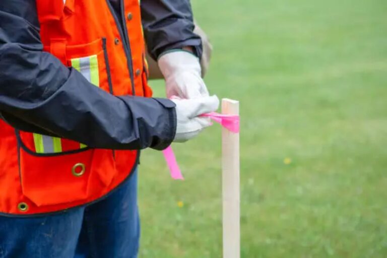
The Process of Conducting a Cadastral Survey
The process of a cadastral survey begins with thorough research of existing property records and legal documents. Surveyors often look into historical deeds, titles, and previous survey maps to gather necessary information. This initial research helps establish a clear context for the land being surveyed. Understanding the historical significance of the land can also provide insights into any potential easements or rights of way that may affect the property.
Next, the surveyor conducts fieldwork, which involves physically measuring distances and angles to determine property boundaries accurately. Advanced technology, such as Global Positioning Systems (GPS) and Geographic Information Systems (GIS), may be utilized to enhance data accuracy. After collecting this information, the surveyor compiles the data into a detailed survey map that illustrates the boundaries, dimensions, and area of the property. This map not only serves as a legal document but can also be a valuable resource for landowners, providing them with a visual representation of their property that can be used for future planning or development projects. Additionally, the final survey report often includes notes on any observed encroachments or discrepancies, which can be crucial for resolving any future disputes that may arise regarding the property boundaries.
Benefits of Cadastral Surveys
Cadastral surveys offer a multitude of benefits that extend beyond mere land measurement. These surveys provide a legally recognized document that can be crucial in the event of a dispute. With a well-conducted cadastral survey, property owners can present objective evidence of their boundaries if challenges arise, thus protecting their rights.
Legal Protection for Property Owners
One of the most significant benefits of conducting a cadastral survey is the legal protection it affords property owners. In many jurisdictions, a properly registered cadastral survey can serve as evidence in court should disputes over property boundaries occur. This legal backing makes it difficult for neighbors to successfully claim encroachment without substantial proof.
Additionally, a cadastral survey ensures that property owners remain compliant with local government regulations. As local ordinances and land-use policies can be influenced by survey results, having an up-to-date cadastral survey can protect owners from inadvertent violations that might incur fines or other penalties. This compliance not only safeguards the property owner’s investment but also contributes to the overall integrity of land management in the community, fostering a sense of order and respect for property rights.
Enhancing Property Value and Marketability
A cadastral survey also enhances the marketability of a property. When a property is sold, buyers typically seek assurance regarding boundaries and ownership. An up-to-date cadastral survey acts as a selling point, providing prospective buyers with confidence in the transaction.
Furthermore, properties with clear boundary definitions can often fetch higher prices on the market. Buyers are willing to pay a premium for land with established rights, as they perceive less risk associated with the property’s legal status. Hence, investing in a cadastral survey can be a wise decision for current and future property owners. In addition to increasing market value, a clear understanding of property boundaries can also facilitate smoother negotiations during the sale process, reducing the likelihood of misunderstandings or disputes that could derail a potential deal.
Moreover, having a cadastral survey can also open up opportunities for development and land use that may not have been previously considered. For instance, property owners may discover that their land can be subdivided or developed in ways that were not apparent without a detailed survey. This newfound knowledge can lead to innovative uses of the land, whether it be for residential, commercial, or agricultural purposes, ultimately maximizing the property’s potential and increasing its overall utility in the marketplace.
Common Misconceptions about Cadastral Surveys
Despite their importance, there are several misconceptions surrounding cadastral surveys. These misunderstandings can lead to confusion and hesitance among property owners seeking to protect their rights. Visit https://www.academia.edu/48103273/Cadastral_Systems_within_Australia to get about cadastal systems within australia.
Myth: Cadastral Surveys Are Only Necessary for Large Land Parcels
One common myth is that cadastral surveys are only relevant for large tracts of land. In reality, even residential properties and small parcels benefit significantly from accurate boundary delineation. Any landowner can experience disputes with neighbors; thus, having a clear cadastral survey is beneficial no matter the size of the property. Additionally, small properties can have intricate boundaries that may not be apparent without a professional survey, especially in urban areas where properties are closely packed together. A well-defined boundary can prevent encroachments and misunderstandings that might arise from unclear property lines.

Myth: Cadastral Surveys Are Only Required When Selling Property
Another misconception is that cadastral surveys are necessary only during the sale of a property. While they are indeed critical during transactions, performing a cadastral survey periodically is wise to maintain clear and up-to-date records. This practice helps in recognizing potential issues before they escalate into legal disputes. Furthermore, changes in land use, such as the construction of new buildings or alterations to existing structures, can affect property boundaries. Regular surveys can help landowners ensure compliance with zoning laws and local regulations, thereby avoiding costly fines or legal complications.
Myth: Cadastral Surveys Are Too Expensive for Average Homeowners
Another prevalent myth is that cadastral surveys are prohibitively expensive, making them an impractical choice for average homeowners. While it is true that the cost of a cadastral survey can vary based on the complexity of the property and the region, many homeowners find that the investment pays off in the long run. The peace of mind that comes from knowing one’s property boundaries can be invaluable, especially in preventing disputes that could lead to costly legal battles. Moreover, many local governments offer resources or assistance programs to help homeowners understand the surveying process and its associated costs, making it more accessible than many realize.
See Also : The Importance of a Boundary Survey Before Buying Property
Conclusion
In conclusion, cadastral surveys serve as a vital instrument for property owners aimed at protecting their rights. By understanding how these surveys work, their benefits, and dispelling common myths, property owners can take proactive measures to safeguard their investments. Whether for residential, commercial, or agricultural land, a cadastral survey is an essential step in ensuring the long-term security of property ownership.
In this age where property disputes are prevalent, investing time and resources into a cadastral survey can make all the difference in effectively securing your property rights and enjoying peace of mind regarding your land ownership.